
Friday’s forecast:
The storms that formed Thursday brought in a tremendous amount of rain in a short amount of time. Because of this, the National Weather Service moved the flood watch to include cities like Houston, Sugar Land and the Woodlands through 7pm Friday.
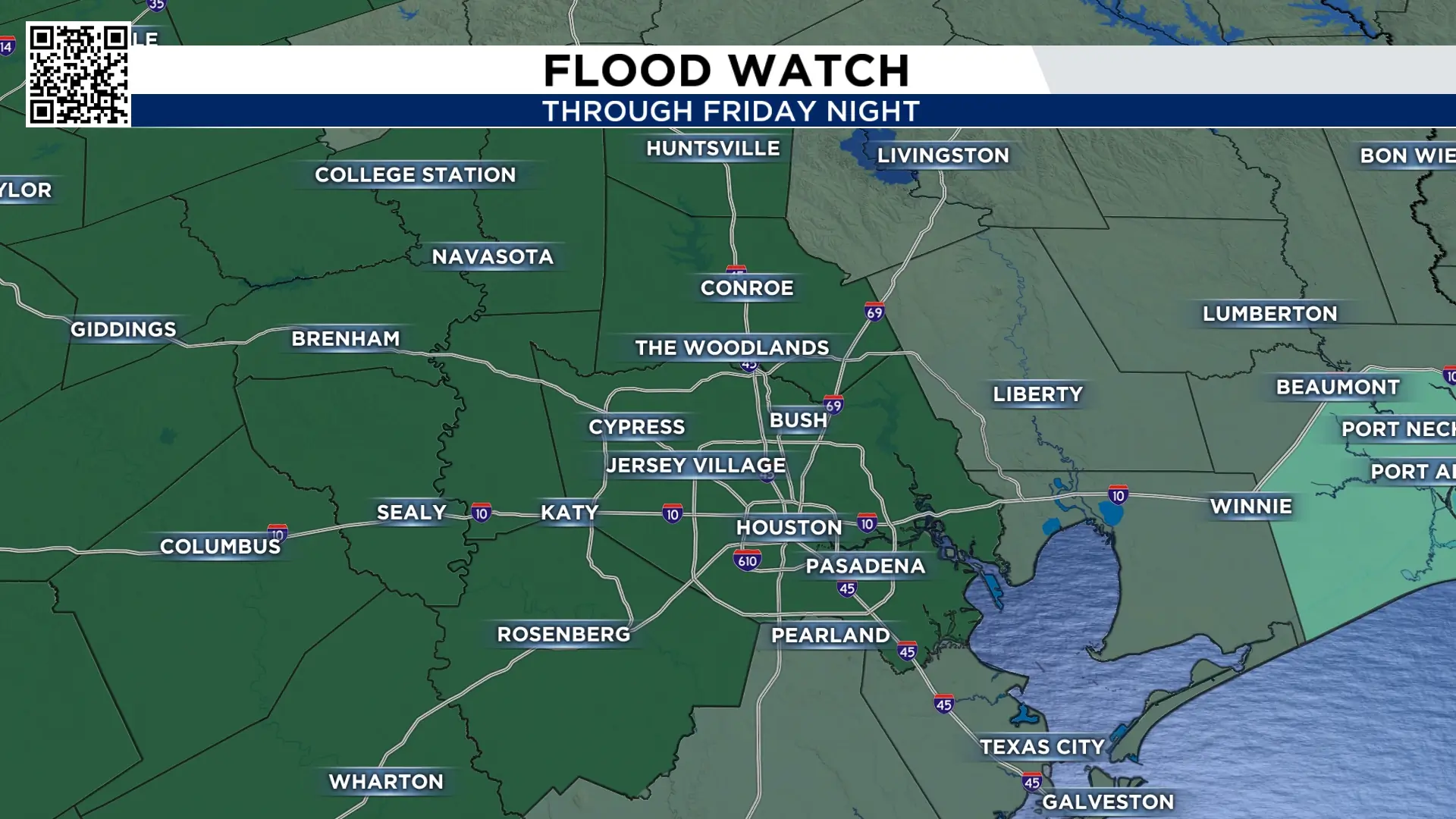
Timing:
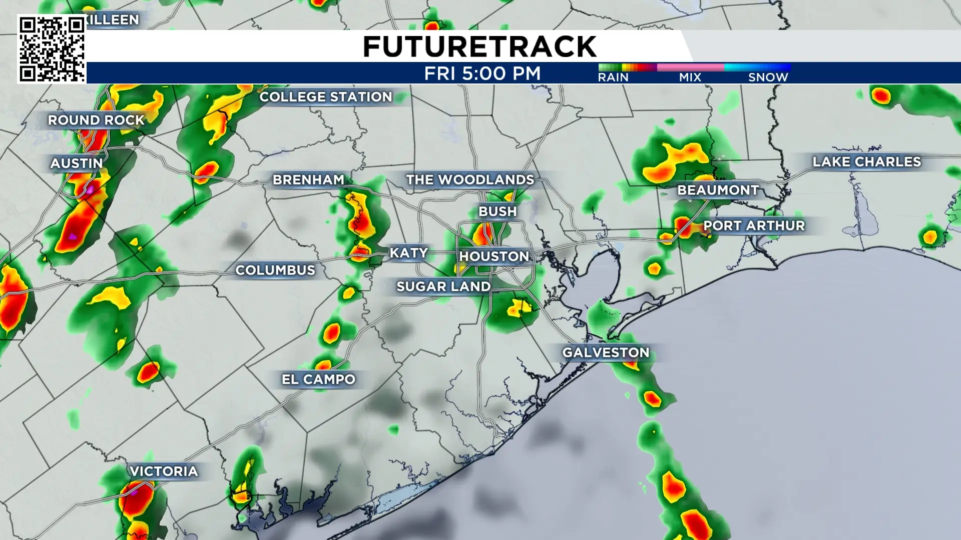
The heaviest rain in the Houston area is expected through Friday morning with some very slick roads. A bit of a break but then more storms coming for the afternoon and early evening.
Saturday:
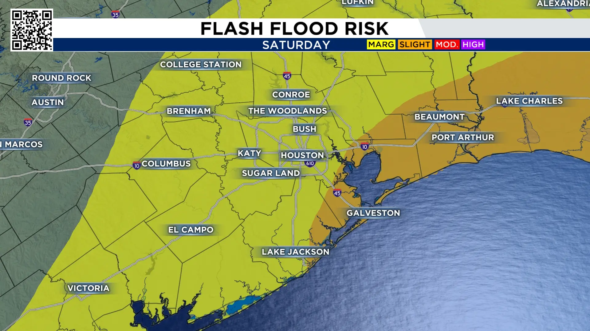
What we can’t see with our eyes, is how much tropical moisture is in our atmosphere. But once it becomes rain you realize how heavy it is. Make sure you have back up plans Saturday because the storms that form will be strong with lots of lightning.
Sunday:
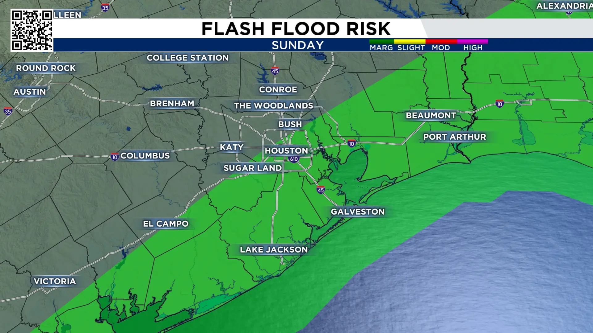
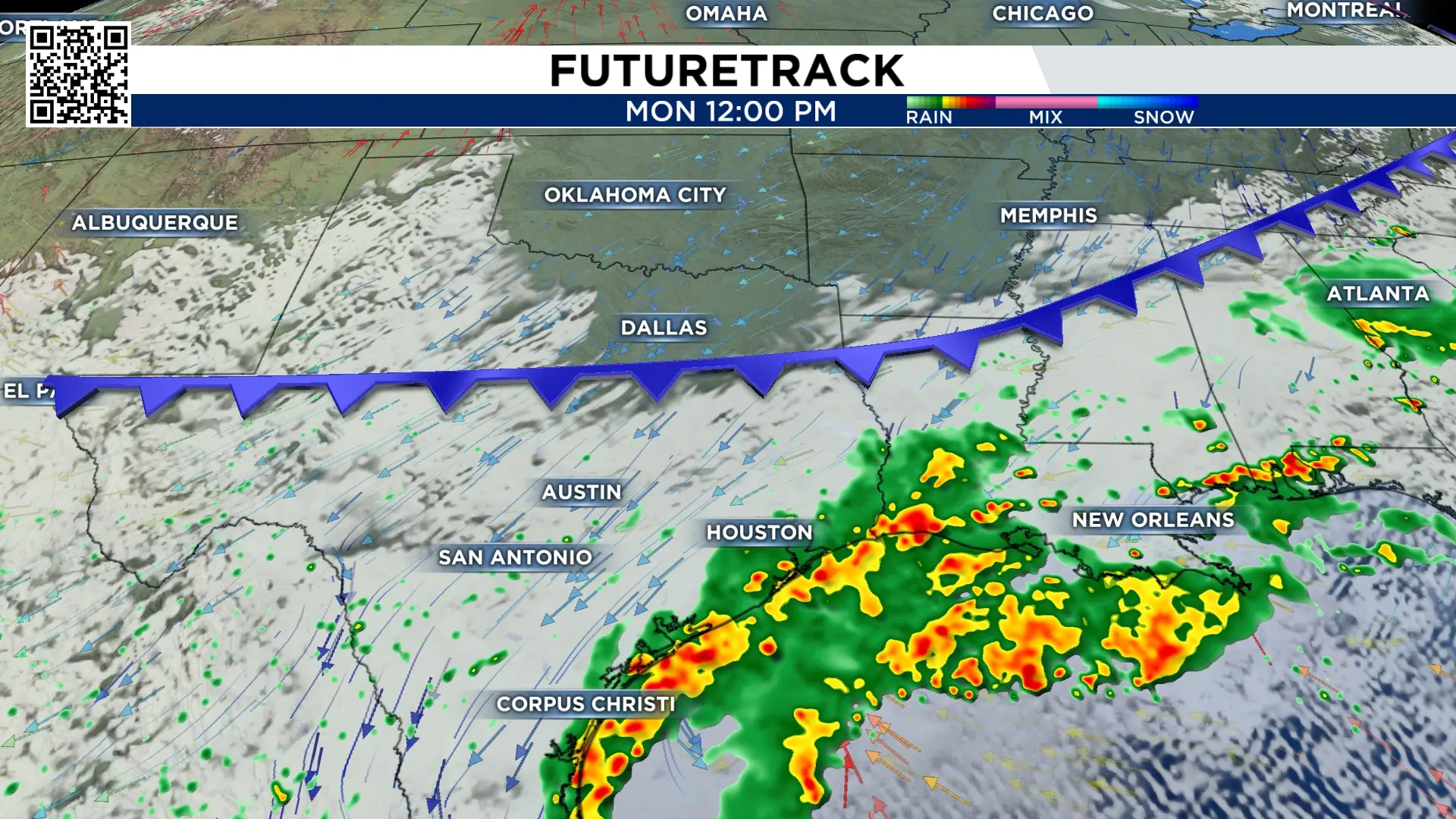
There is enough of a push from the front to the north that most of the rain that falls Sunday will fall along our coastal cities. The threat of flooding is from Houston south.
Monday and Tuesday:
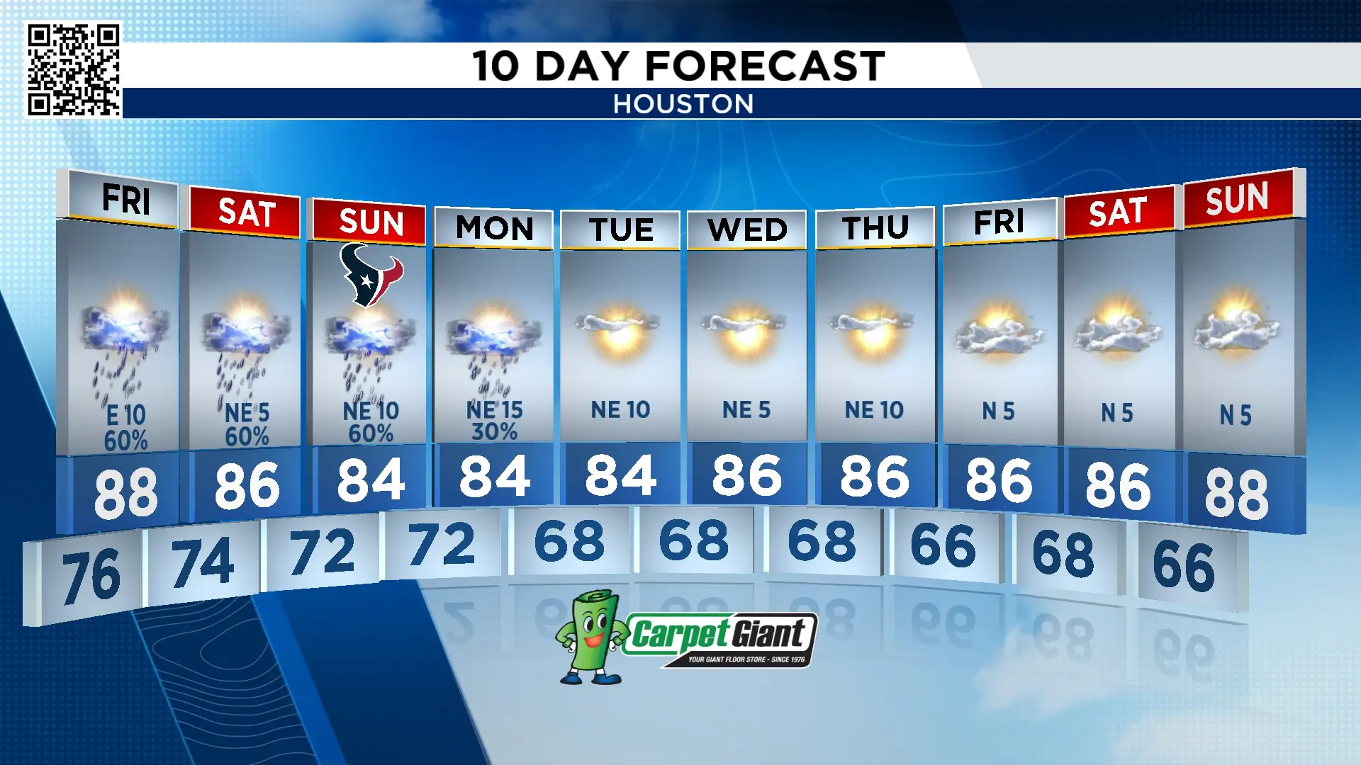
Monday is our last chance of rain for a while. On Tuesday a cold front will move through southeast Texas. This front will bring sunny skies, low humidity and morning temperatures in the 60s! The afternoons fall to the mid-80s so it’s still warm, but the dry air will feel great!
Tracking the tropics:
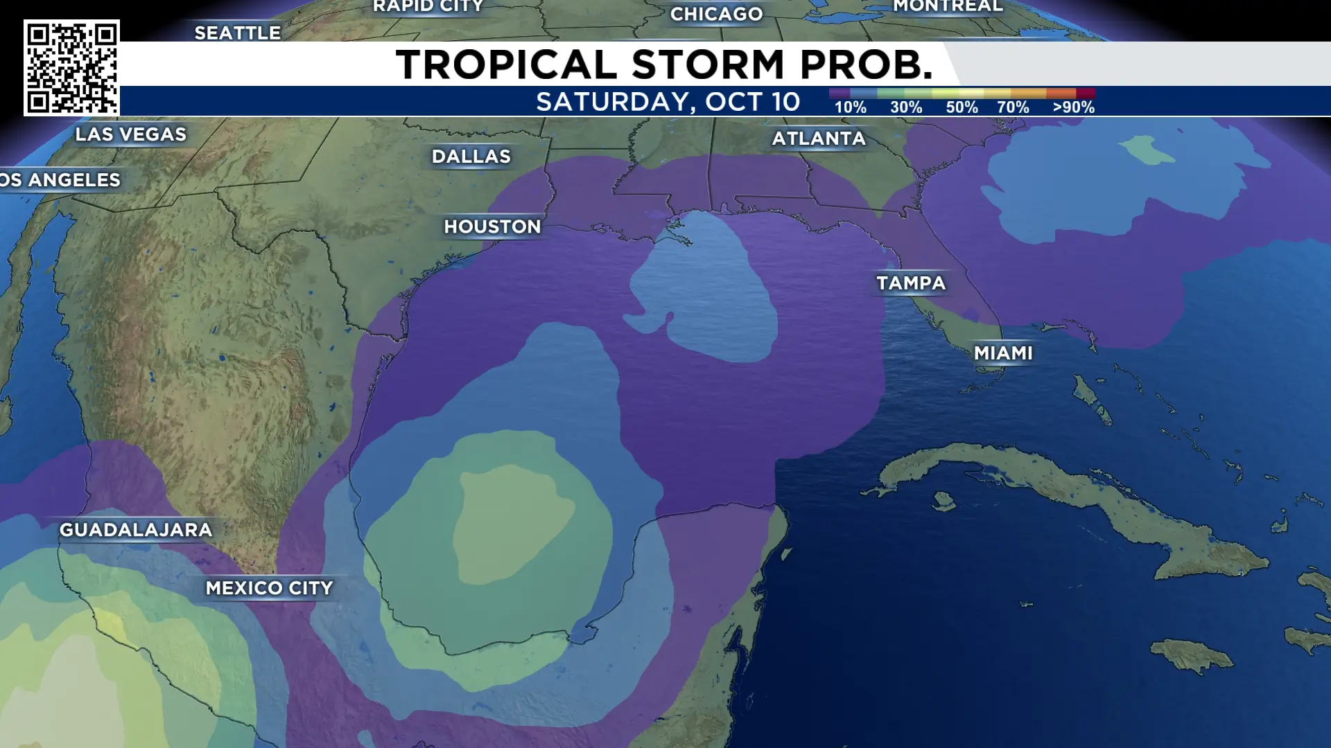
The Atlantic basin remains remarkably quiet. The one thing we’re watching is the Bay of Campeche next weekend. There is a 40% chance this becomes a tropical system. It most likely won’t head in our direction but this is the area that will need monitoring this week.
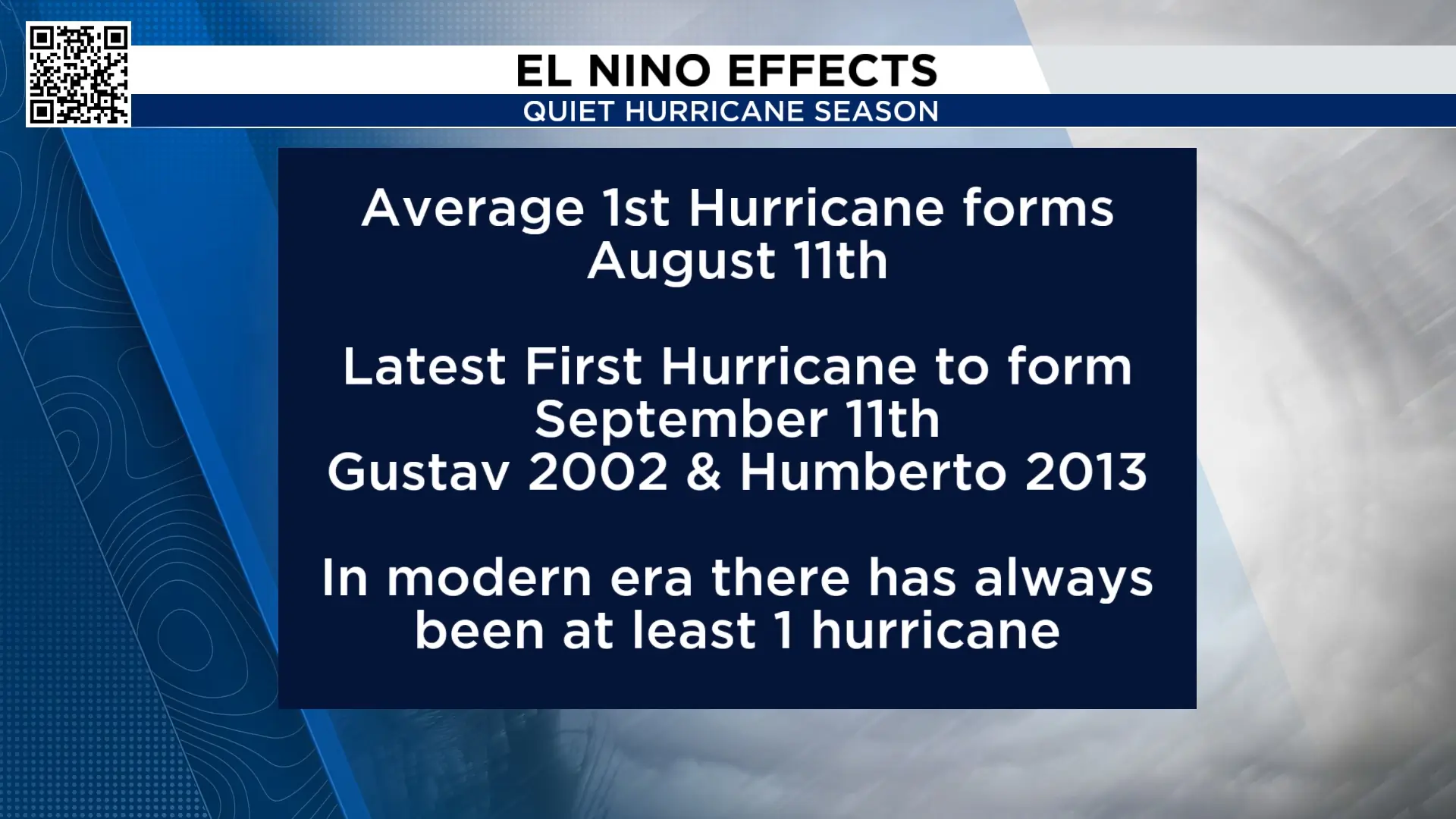
So far this hurricane season we’ve had eight tropical storms. We have not had a hurricane in the Atlantic basin. The latest first hurricane to form was Gustav and Humberto, which formed on September 11th. This means our 2026 hurricane season set a record for the latest hurricane to form.
Extended forecast:
Rain chances are with us through the weekend so having some alternative plans is a good idea. Check out next week’s winds. That northeast breeze is bringing dry air, low humidity and cool mornings.

More Stories Like This In Our Email Newsletter

